Modern Archaeological Surveys
 Interpretation of archaeological evidence captured on aerial photographs is one of the ways that is used to locate new archaeological sites and characterise the historic environment
This method was undertaken in a systematic way for the landscape centred on Bokerley Dyke by the Royal Commission for Historic Monuments (now subsumed by English Heritage) (Bowden 1991)
However the AONB has yet to be covered by the National Mapping Programme.
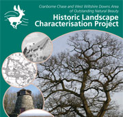
More recently English Heritage has promoted a programme of Historic Landscape Characterisation which studies the historic development of the modern day landscape. The AONB undertook a programme of Historic Landscape Characterisation between January 2007 and July 2008.
Further Reading
- Bowen, H. 1990 The Archaeology of Bokerley Dyke. HMSO: London. 120: 39-44.
Download a short introduction to the history of archaeological discovery in the AONB (PDF 851 KB).
This document forms part of the wider AONB Historic Environment Action Plans.