Historic Routeways in the Landscape
Routeways are notoriously difficult to date, the origins of routeways can be traced backwards through time using modern and Historic Ordnance survey maps, enclosure maps and awards, and tithe maps.
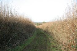
Pre Roman ancient routeways are very difficult to trace in the landscape. It is possible that the ancient track ways across the chalk ridges of the AONB have considerable antiquity.
At a landscape scale the most visible elements of the network of tracks used in the Medieval period are the east west routes which traverse the chalk escarpments of the
Turnpikes represent the first systematic system of 'made' roads across the country since the Roman Road. Created by Act of Parliament the turnpikes of the AONB remain as fairly legible components of the historic network.
The heyday of the turnpike roads was extinguished by the coming of the railways. The two railways lines which still exist in the AONB were built in the 19th century. There are also several relic military lines in the AONB. The creation of the railways in the 19th century had a major impact on the settlements of the AONB with for example, the lessening of the importance of Hindon with the dwindling of the London Exeter coach road, and the rise in the importance of Tisbury.
Highway districts were created under the Highway Act of 1862 following the breakdown of the Turnpike Trusts. These paved the way for the modern highway authorities.
More information on the historic routeways of the AONB can be accessed by clicking here: Theme 10: Routeways in the Landscape.
This document forms part of the wider AONB Historic Environment Action Plans.