Late Medieval AD 1066 - AD 1485

The aftermath of the Norman conquest of the AONB is represented by a series of Motte and Bailey castles situated in the greensand hills of the AONB. Medieval settlement in general is represented by the distribution of manor houses such as Woodyates, modern settlement with medieval centres and deserted medieval villages, for example, those located along the Tarrant Valley.
The majority of the AONB was either part of the Cranborne Chase or of Medieval hunting forests such as Selwood, or Grovely. These were codified in law and allowed the crown or magnate who had control of the rights to hunt deer over the land, restrict others activities and exploit revenue through the imposition of fines and the management of timber and grazing rights
Evidence for Medieval farming in the AONB is represented by limited ridge and furrow, strip lynchets on the chalk escarpments and the fossilisation of strips in modern fields . These fields existed within a mixed pattern of rough grazing, open downland, common land and woodland. The expansion of agriculture is represented by the creation of new market places such as in the planned town of Hindon. The importance of livestock in this period is hinted at by the great drove roads which are located along the tops of the chalk escarpment and downland and allowed access to important markets such as Salisbury.
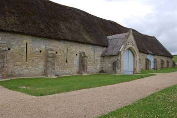
The importance of the church in the medieval period in the AONB is represented by the great tithe barn and abbey remains at Tisbury, parish churches and smaller features such as crosses.
The impact of the nobility can also be seen in the landscape with the establishment of fortified manors and castles such as Wardour.
Environmental Evidence - There is a lack of environmental evidence from sites within the AONB for this period.
This document forms part of the wider AONB Historic Environment Action Plans.
