Open Land
 Today the open downland of the AONB is limited to small areas on the edge of escarpments, in steeped sided coombes or to nature reserves such as at Martin Down in Hampshire. However historic ordnance maps show that
as recently as 50 years ago the AONB was dominated by open downland.
Today the open downland of the AONB is limited to small areas on the edge of escarpments, in steeped sided coombes or to nature reserves such as at Martin Down in Hampshire. However historic ordnance maps show that
as recently as 50 years ago the AONB was dominated by open downland.
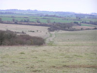
Open Land in the AONB has a very restricted distribution. There are distinct concentrations of surviving open land firstly in the area surrounding Martin Down, to the north of Mere and to the north of Shaftesbury around Semley Common. The area around Semley Common forms the only surviving common land in the AONB; common land is an unusual feature in the 21st landscapes of England. The surviving open chalk downland represents traces of what would have once been large tracts of open downland. In the 18th and 19th century this land formed a major part of the sheep/corn husbandry system of farming. Much of this land was transformed into fields in the 19th and 20th century, leaving only small areas.
The other types of open land represent the survival of land which would have been on the edge of settlements and fields in the past and often was poor quality agricultural land such as marsh or heath. This land did, however, represent an important resource in the past, and much of the scrubland and rough grazing, for example, was subject to common rights. The escalating process of enclosure culminating in the intensification of farming in the 20th century meant that this land was increasing encroached upon to the extent that only fragments were left in the landscape.
More information on the open land of the AONB can be accessed by clicking here: Theme 9: Open Land in the Landscape.
This document forms part of the wider AONB Historic Environment Action Plans.